
UK weather: New weather map shows exactly when ‘heavy’ snow could hit Nottingham this month

Temperatures in Nottingham are predicted to plummet next week
Heavy snow could hit Nottingham later this month, according to a new weather map.

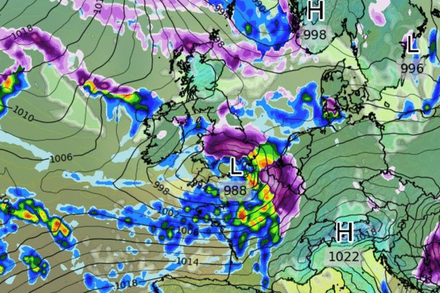
Interactive global weather forecaster WX Charts, which uses Met Desk data, shows a band of snow sweeping across the East Midlands on Thursday, November 21.
According to WX Charts, the snow will arrive from the west, before hitting mainland Europe.
Current forecasts from WX Charts predict that up to 5cm of snow could fall in Nottingham on November 21.
When will it start turning colder?
The Met Office says that a northerly airflow is likely to drop temperatures further from the north through the weekend and at the start of next week.
Met Office meteorologist Mark Sidaway said: “While temperatures will gradually decline through this week, there’s potential for a colder period of weather to develop from the weekend.
“At this range there’s still much detail to be worked out, but a more unsettled start to next week is likely, with a chance of frost and ice for some.”
“This drop in temperatures heightens the chance of some snow to high ground in the north of the country, though there is still a minority of scenarios which could bring some snow to lower levels at times.
“Needless to say, we’ll be assessing the forecast for this period more in the coming days, but a colder spell of weather is likely, with some gusty winds also possible for some.”